FeatureMap can be used for free for an unlimited period of time, but if you want to use some advanced features such as Word/Excel exports or unlimited maps, you’ll have to subscribe to a Premium account.
Premium FeatureMap grants you you to export your map into various formats; documents, an image or even another application.
In this blog post we will take you through every step of the process.
We support export for file formats and platforms as below:
- CSV
- XML
- JSON
- Microsoft Office Documents
- PNG image
- Atlassian JIRA
- Trello
Export
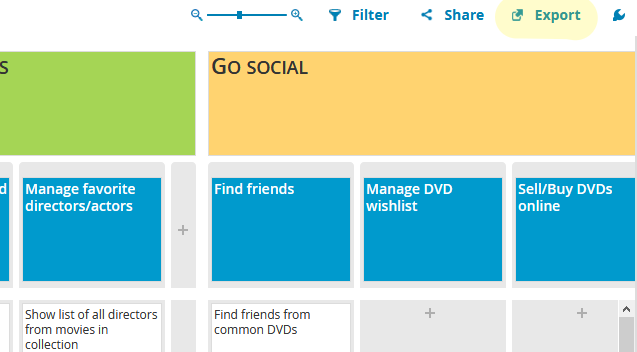
I will be using the MovieBuddy Product Map as examples so you can follow along.
To get started with Export go to your map and click at the top right – “Export”
Here you will be given four different options:
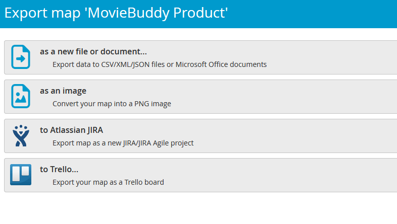
As a new file or document…
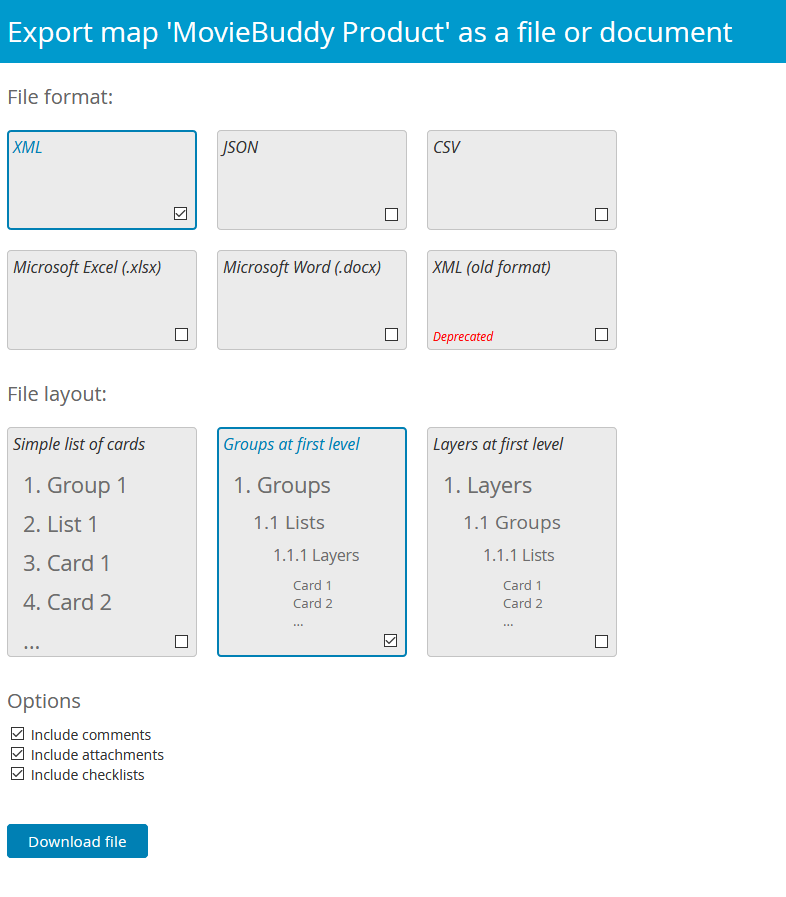
Choosing to export as a new file or document will allow you to export your map as a CSV, XML, JSON, XLSX, and DOCX.
As well as support each file format, some of the file formats support different file layouts to give you full control of how your document is presented:
- Simple list of cards
- Groups at first level
- Layers at first level
In addition we also have the option to add comments, attachments and checklists to your export. Some exports do not need to show all the details so these options can be disabled.
Export map as image
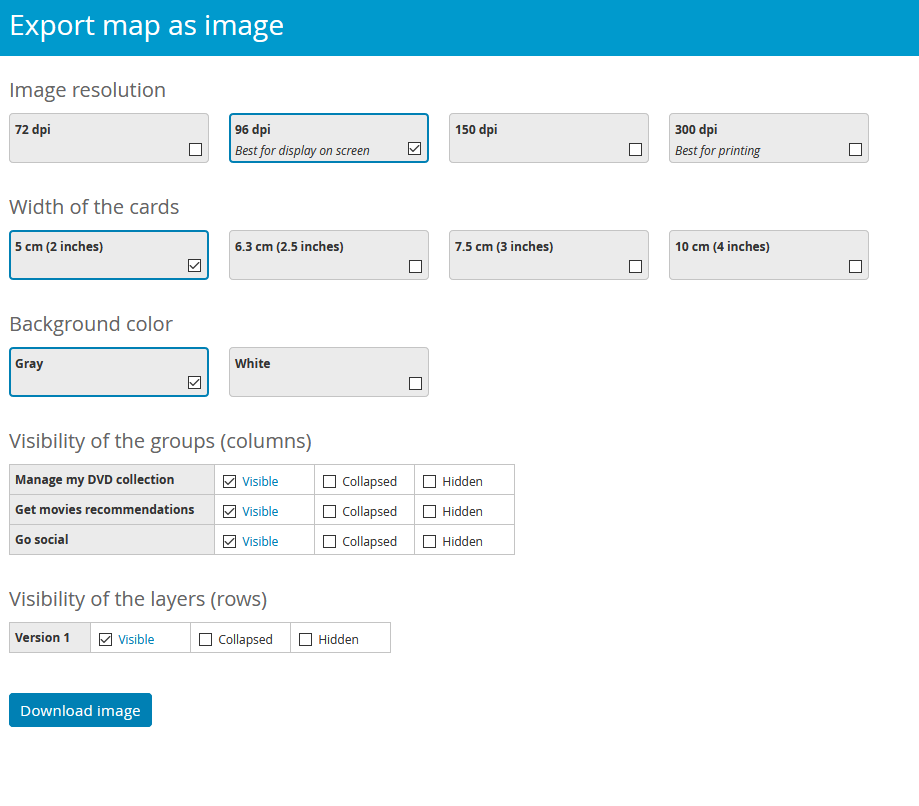
When exporting as an image we generate your image as a PNG format.
We realise that this can be used for printing large images for your work environment or simply having a copy for digital display and so we offer four different DPI versions. Please consult your printer for the ideal DPI, but we recommend 300 DPI for paper printing.
- 72 dpi
- 96 dpi (best for display on screen)
- 150 dpi
- 300 dpi (best for printing)
In addition we wanted to give you further control of your image so we offer different widths of the cards:
- 5cm (2 inches)
- 6.3cm (2.5 inches)
- 7.5cm (3 inches)
- 10cm (4inches)
We advise selecting these options first with a low resolution image to find the best format and then opting for a higher DPI for when you are happy with the width.
We also offer printer friendly grey and white background options.
We also give full control over your columns and rows. If you wish a column (group) to be displayed in full, collapsed or hidden entirely.
Trello
When exporting to Trello you will first need to connect Trello and FeatureMap together by following the on screen prompts.
We will never take your information and use it for other than connecting FeatureMap and the desired service.
Once you have connected Trello and FeatureMap you can remove those permissions at any time from Trello.
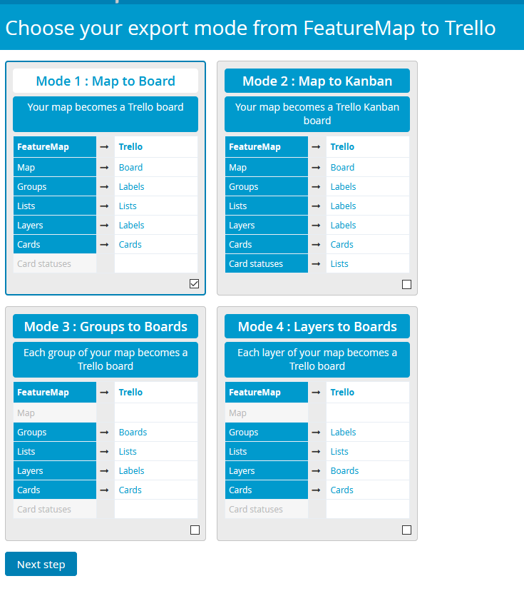
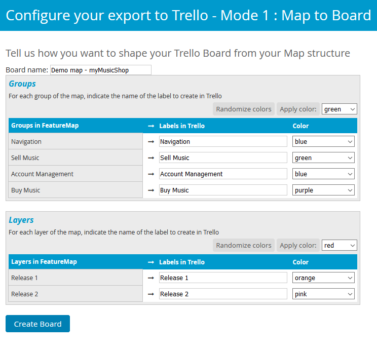
Here you can choose how the export of your FeatureMap will be translated over to Trello.
- Map to Board
- Map to Kanban
- Groups to Boards
- Layers to Boards
Each setting can be repeated into new maps, the image above shows what turns into what.
Please note that creating the board may take some time as FeatureMa.
You can see an Example below:
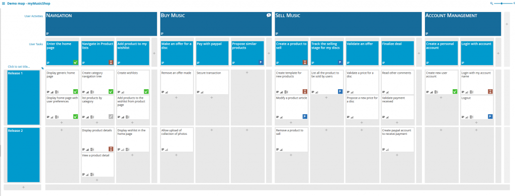
This Demo Map is exported into the Trello Board Below.

Of course this can be exported in multiple formats.
Atlassian and REST API
For Atlassian and Trello navigate to Export and follow the on screen wizard to connect your account by allowing permissions.
A future Blog post will explore the optional JIRA Integration options.
Finally, we also have REST API where you can develop, edit and create your own export/import functions within your own REST framework.